Projects
Generative AI for Satellite Data Reconstruction
The Problem
Space-borne remote sensing enables continuous global observation, yet all satellite systems encounter sampling limitations to varying degrees. In satellite oceanography, it is standard practice to employ physics-based methodologies to address gaps in measurement data. Traditional approaches include simple optimal interpolation and more advanced data assimilation techniques that integrate primitive-equation numerical models. However, these methods have drawbacks: optimal interpolation relies on assumed a priori correlation functions, limiting its accuracy, while data assimilation is computationally intensive. AI-driven methodologies offer a promising solution, overcoming both the restrictive assumptions of interpolation and the computational burden of assimilation. Example Projects
Below is an incomplete list of projects undertaken by our working group teams to explore and apply generative AI for reconstructing satellite data:
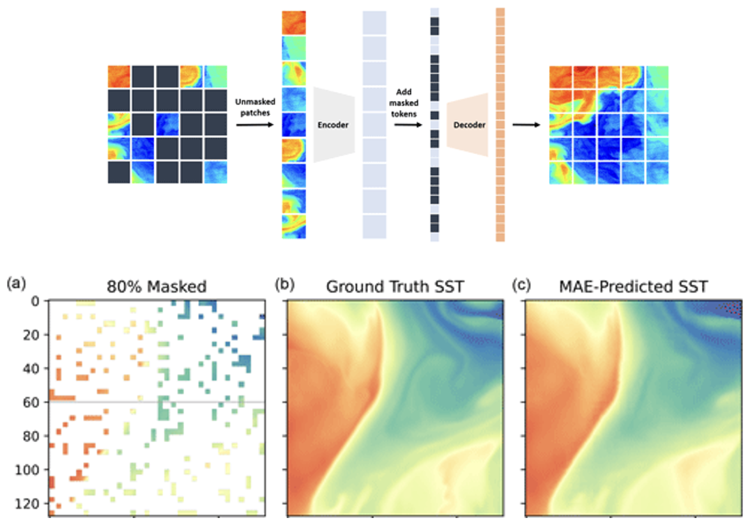
1. MAESSTRO: Masked Autoencoders for Sea Surface Temperature Reconstruction under Occlusion
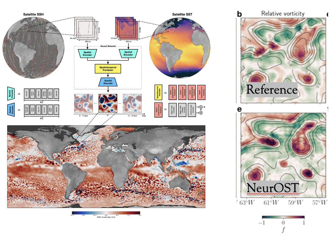
2. NeurOST (Neural Ocean Surface Topography): Deep Learning Improves Global Satellite Observations of Ocean Eddy Dynamics
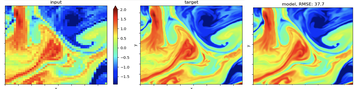
3. Machine learning-driven super-resolution techniques to enhance the resolution of oceanographic satellite imagery
Get Involved
Guidelines for project collaboration.